With a stunning waterfront, a collection of more than 120 historical structures, and a central locale in the heart of the Crystal Coast, it should come as no surprise that Morehead City can be a scene stealer when it comes to eye-catching scenic spots in the Southern Outer Banks.
And whether a visitor wants to stroll from one picturesque destination to the next, or embark on an adventure that lands in some of the prettiest yet isolated places in the region, there’s plenty of options for catching that perfect sunset, or perfect photo. After all, it’s this unique on-the-water atmosphere that keeps Morehead City visitors coming back again and again, and it’s the reason why new visitors almost immediately fall in love with Morehead City’s inherent coastal charm.
Scenic Spots About Town in Morehead City
One of the best (and easiest) ways to begin a “scenic spot hunt” in Morehead City is to start in the heart of the downtown area. And while the gorgeous waterfront grabs most of the attention, visitors will soon discover that there are a wide variety of in-town parks, sites, and destinations that are worth a visit for an amazing view.
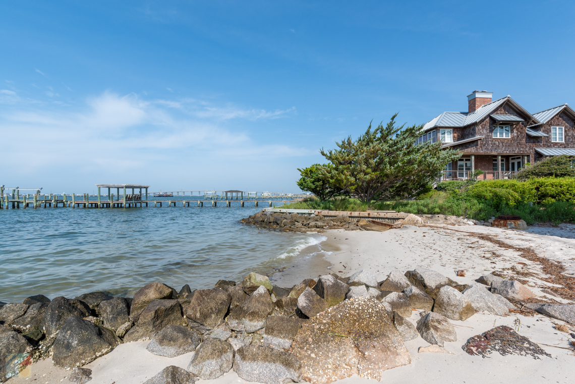
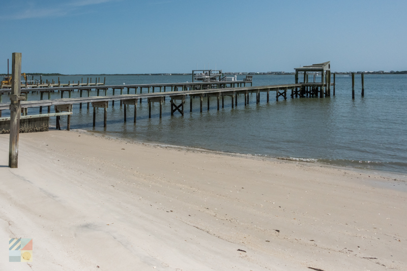
Downtown Morehead City Waterfront
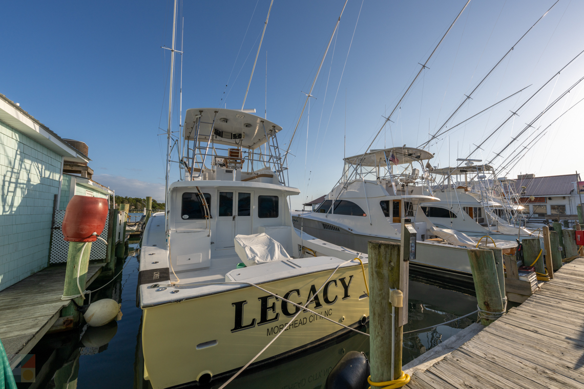
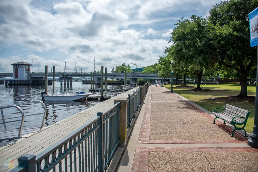
One of the best ways to take in Morehead City’s brimming waterfront activity is via a stroll along the waterfront, and the great news is that exploring the edge of the downtown area is a wonderfully easy affair. Visitors can start their expedition on the edge of Shepard Street or Evans Street, and simply follow the wide bulkhead docks to encounter number of local charter fishing vessels, a dive shop, and a unique collection of statues while en route (including a Cape Lookout Lighthouse replica and a giant statue of King Neptune.) Expect to see vessels of all sizes cruising along the outlying Intracoastal Waterway, as well as some pretty spectacular sunsets and a handful of waterfront bars or restaurants where it’s easy to grab a drink, a meal, and linger over the scene.
Jaycee Park
The small triangular Jaycee Park takes up less than ½ a block of Downtown Morehead City but it’s easily the best place to go for long views of the open waters and the not-so-distant Sugarloaf Island. The site serves as the venue of choice for summertime concerts and special events, but it’s also an enticing scenic site for everyday visitors, thanks to ample seating options and a peaceful atmosphere in the heart of the action. Settle into a shaded porch swing on the water’s edge, or relax in the on-site gazebo that’s just yards away from the water. No matter how you choose to relax, the incredible views in the heart of the downtown area make this centrally located park worth a visit or two.
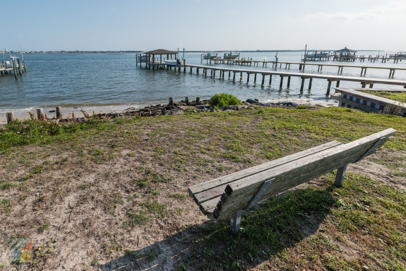
South 12th Street Water Access
For a quieter view of the downtown waterfront, (or just a nice spot to enjoy a picnic lunch), visitors can head to the South 12th Street Water Access. This small sliver of land on the western edge of the downtown area borders a couple of pretty historic homes, and refreshingly, not much else, which makes it a nice destination to catch a view with little to no company. The site features a lone bench and a picnic table, and visitors should note that parking is limited, so a stroll along the waterfront may be required to reach the scenic site.
South 13th Street Water Access
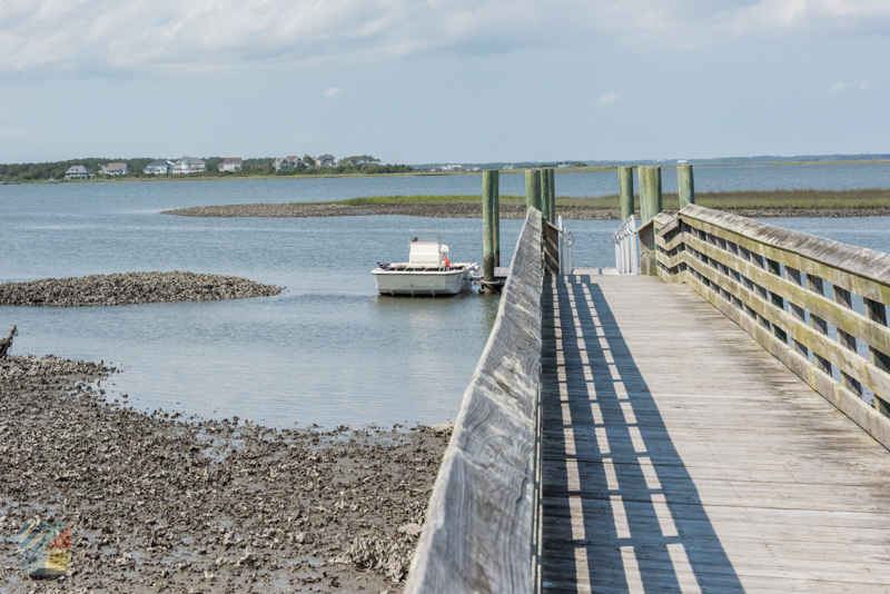
Head to the edge of 13th Street – a small and primarily residential road on the western edge of Downtown Morehead City – to reach this small public water access site that’s also popular with local scenery lovers in-the-know. This small wedge of land features a boardwalk that extends into the Harbor Channel / Bogue Sound, and which serves as a prime viewing point to enjoy endless open water vistas. Binoculars may come in handy to catch the local egrets and herons at play, and visitors should note that parking is severely limited, so a walk through the downtown area may be required to access this waterfront destination.
South 28th Street Water Access
Visitors can enjoy a not-so-distant view of the Atlantic Beach Causeway, as well as Sugarloaf Island and the downtown region to the east, with a visit to this slight water access point that’s found along the mainly residential 28th Street. This water access site features a concrete walkway that leads to the water’s edge where a picturesque bench overlooking the scene can be found, which makes it a prime destination for couples who want a romantic spot to catch an evening sunset. Limited parking is available close to the site.

Sunset Drive Water Access
Head to the corner of Sunset Drive and 32nd Street to reach this scenic destination that’s ideal for catching a sunset, or just admiring a view of the outlying Atlantic Beach shoreline. This small public water access site features a boardwalk that extends all the way to the water’s edge, as well as a tidal-influenced sandy beach that can serve as the perfect spot for a picnic blanket or beach chair. Parking in the area may be limited, but visitors to this almost-secretive site will often find that they have this pristine spot all to themselves.
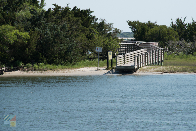
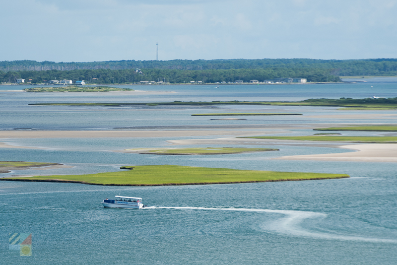
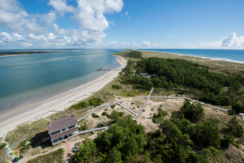
Sugarloaf Island
Map it (boat access only)
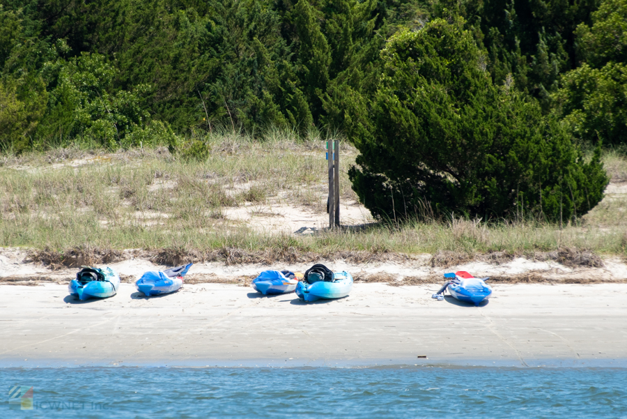
Downtown Morehead City looks its best from a waterfront perspective, and visitors can capture incredible photos of the heart of town, (as well as up-close shots of the local wildlife), when they pay a visit to this remote 22-acre island that’s located just across the Harbor Channel from the Morehead City waterfront. Though only accessible by a small vessel or kayak, visitors will find the efforts to reach this destination are more than worth it thanks to an on-site nature trail, restrooms, and stunning views that can encompass the downtown region as well as the open Bogue Sound waters, depending on where on the island a visitor explores. Birdwatchers will especially adore this locale, as the undeveloped terrain and varying habitats makes it a popular destination for flocks of migrating birds that are traveling along the Atlantic Flyway.
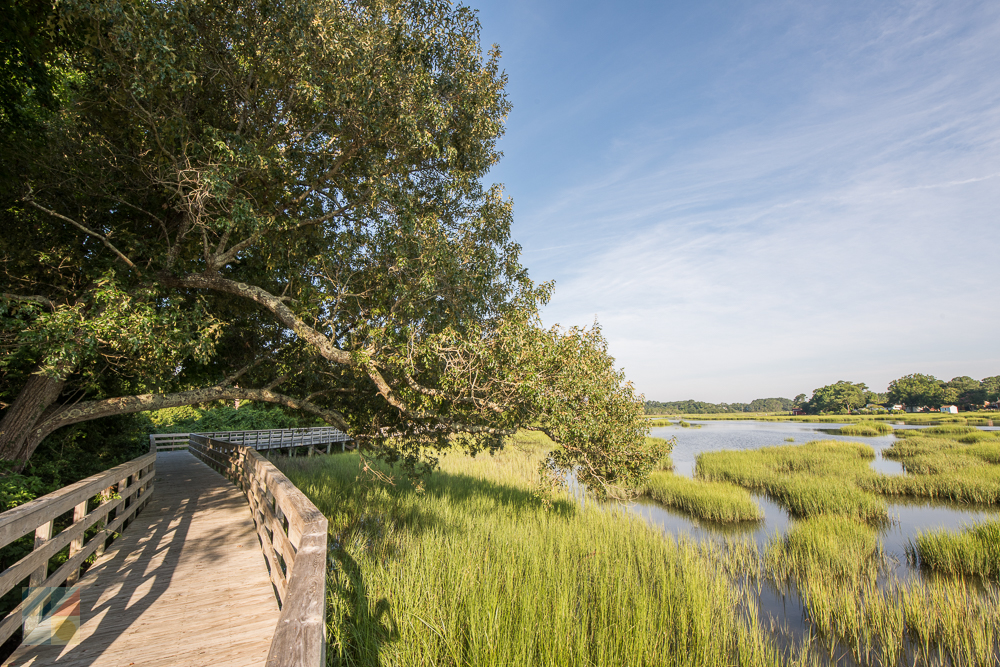
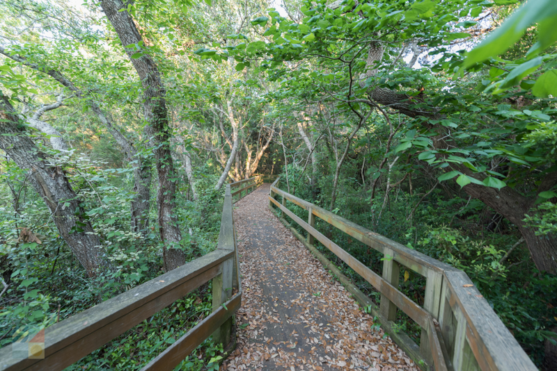
Calico Creek Boardwalk
Head north of Arendell Street, just outside the downtown region, to encounter this scenic boardwalk that hugs the edge of Calico Creek – a small and somewhat salty body of water that eventually connects with the Newport River. Located in between North 19th and North 22nd Street, this wooden boardwalk often hovers above the water, presenting unparalleled views of the abundant wildlife below, and in all surrounding directions. As such, it’s a solid destination for birdwatchers, as well as anyone who appreciates a walk along – or over – the water’s edge.
Conchs Point
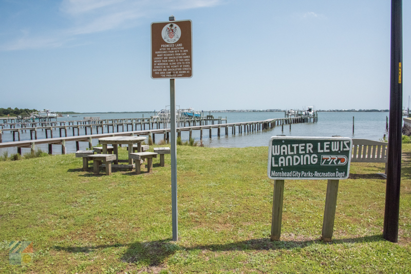
For a secretive sunset or sunrise spot that only the locals know, head to Conchs Point – a pretty water access point that’s located at 608 Bay Street, or just north of the heart of the Morehead City downtown area. This site features limited street side parking, but it also boasts a walkway that leads to a stunning waterfront gazebo and floating dock on the edge of Calico Bay, which makes it an enticing destination for kayakers, anglers, birdwatchers, and any visitor who appreciates a natural scene with limited company.
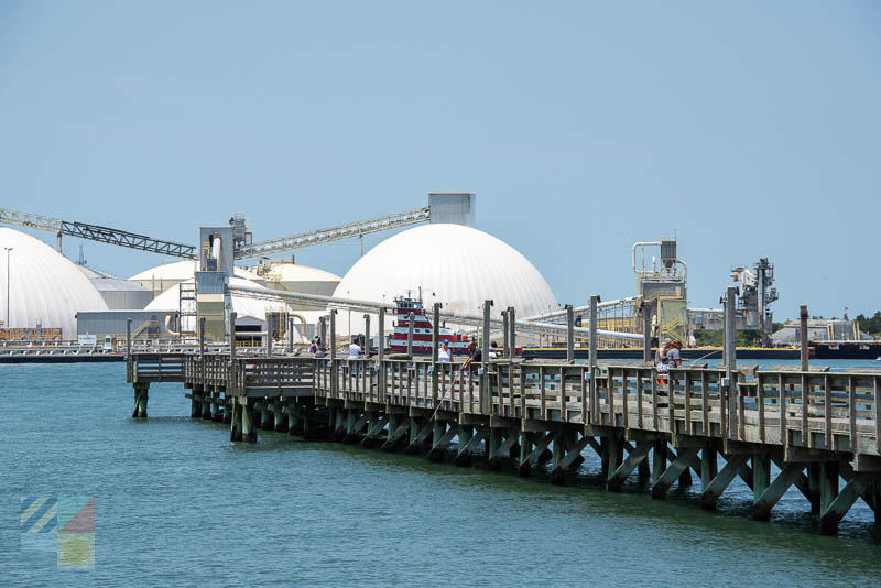
Newport River Pier
Well known as a popular launching point for both anglers and Intracoastal Waterway-visiting mariners, the Newport River Pier and Ramp is also a nicely accessible destination for sightseers who want to enjoy an unforgettable view of the surrounding waterfront terrain. Located in between the towns of Morehead City and neighboring Beaufort, this site that’s surrounded by water features ample parking, restrooms, and a fishing pier that extends 575’ ft. into the river waters. Head to the end of the pier to watch the local anglers reel in catch after catch, and to enjoy a panoramic vista of the river and nearby Morehead City commercial fishing center.
Scenic Destinations in the Area
Morehead City borders a number of enticing Crystal Coast communities. From the beaches of the adjacent “Emerald Isle” to almost hidden traditional maritime towns, there’s a lot to see with an easy 5-20 minute drive from the Morehead City town borders.
Downtown Beaufort
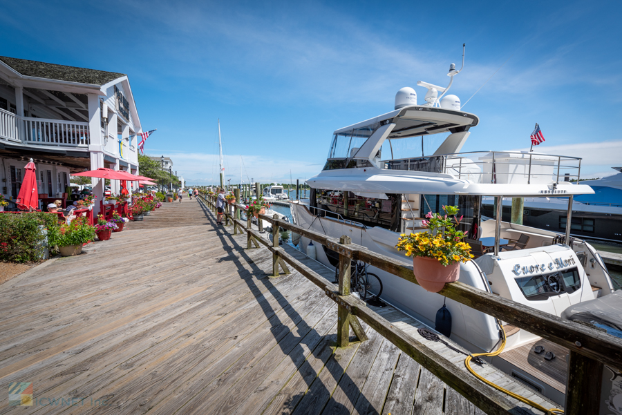
Beaufort is renowned as the third oldest town in the state of North Carolina, and this coastal destination that’s next door to Morehead City has a stunning downtown region where local nautical supply stores, chic boutiques, and waterfront restaurants or coffee houses can all be found. A scenic exploration can be effortlessly enjoyed with a stroll along Front Street – the main waterfront route through town – where a line of benches, pretty seasonal window boxes, and a steady stream of maritime traffic can all be admired. Take time to peruse the local charter and waterfront tour businesses, which are stationed along the docks, and extend a tour by popping into a waterfront restaurant for a Happy Hour beverage or meal. The ensuing sunset and open water views are definitely worth the visit, and serve as a fantastic excuse to linger and enjoy the scene.
Rachel Carson Coastal Estuarine Reserve
Like Morehead City, Beaufort also has a nature preserve that’s located just across the water from the downtown area. Unlike Morehead City, however, this reserve expands for more than 2,300 acres and is home to herds of wild horses that have occupied the complex of islands for roughly a century or more. Accessible via a kayak, small vessel, or a water taxi, the Rachel Carson Reserve features several mile-long nature trails, as well as a host of local wildlife which includes more than 200 recorded species of birds. As such, a visit to this island complex will be an enticing adventure for birdwatchers and nature enthusiasts of all varieties, as well as anyone who wants a stellar photo op of the Beaufort downtown area from a waterfront perspective.
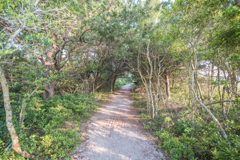
Hoop Pole Creek Nature Trail
Morehead City visitors can take a quick cruise across the Atlantic Beach Causeway to reach a deceptively isolated nature trail that’s found next to the Atlantic Station shopping plaza. The Hoop Pole Creek Nature Trail extends for roughly ½ mile to the edge of the Bogue Sound, and boasts well-tended terrain and walking trails to make a stroll to the water a breeze. Along the way, visitors will enjoy pretty views of the local maritime forests, shrub thickets, marshes, and open waters that are found within this 31-acre parcel of land, and will also enjoy some exceptional birdwatching vantage points. Best of all, because of its short nature, the trail is easy to access for hikers and walkers of all abilities.
Fort Macon State Park
While the iconic Fort Macon is certainly worth a look for its collection of brick and stone walls and 26 vaulted rooms that were constructed in the 1820s, sightseers will want to pay a visit to this attraction for its sumptuous beaches that border the Beaufort Inlet. Located just east of the Atlantic Beach town borders, Fort Macon State Park features miles of undeveloped shoreline as well as brilliant inlet, soundside, and ocean facing views, which makes it an especially scenic spot for an Atlantic sunrise or Bogue Sound sunset. Ample parking is available at several locations, and seasonal restrooms / lifeguards are available within the park as well.
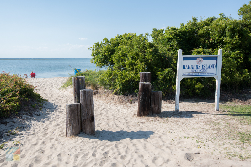
Harkers Island
Morehead City isn’t the only town in the Crystal Coast region with a nautical backbone, and visitors can explore the area’s local maritime culture even further with a visit to the nearby community of Harkers Island. Featuring a main route – Harkers Island Road – which cuts through the region, as well as continual beautiful views of the Core Sound and the Cape Lookout Lighthouse, this community is a great destination for visitors who want to get a taste of the area’s authentic love of life on the water. For more info, which includes area nature trails, swing by the Core Sound Waterfowl Museum & Heritage Center, where a bevy of indoor and outdoor exhibits outlining the natural landscape can be found.
Theodore Roosevelt Natural Area
The 265 acre Theodore Roosevelt Natural Area is often overlooked by coastal vacationers due to its proximity to the grand North Carolina Aquarium at Pine Knoll Shores, but sightseers will want to ensure they schedule some time to discover this perfectly preserved parcel of maritime forest that hugs the Bogue Soundfront. Two roughly mile-long nature trails wind through the preserve, presenting a perfect opportunity to enjoy the dense woods, the local saltmarshes, and – inevitably – the open Bogue Sound waters, all while feeling miles away from the hustle and bustle of the area’s beach towns. Visitors who take the time to explore will want to linger at the sound overlook, where incredible views of the water – as well as a number of different water birds – can be enjoyed and admired with every visit.
Cape Lookout National Seashore
Visitors in the mood for a true sightseeing adventure can commandeer a tour boat or water taxi from Morehead City or neighboring Beaufort to explore the stunning Cape Lookout National Seashore. This 56-mile long collection of barrier islands features desolate beaches, exceptional fishing, great shelling, and small herds of famed wild horses that have been roaming the shorelines for more than 500 years. As a result, the National Seashore is a paradise for sightseers of all natural inclinations, and the vistas just get better when visitors also plan a trip to the Cape Lookout Lighthouse on the South Core Banks. At this seasonally open destination, visitors can climb the 208 steps to the top for an otherworldly perspective of the Atlantic Ocean, the Core Sound, and the pristine shoreline that lies in between. While reaching the Cape Lookout National Seashorecan be tricky – a ferry ride or private vessel is required – the trip itself and the incredible views on the isolated shoreline are always worth the journey for view fans.
Scenic Road Trips from Morehead City
Because Morehead City is located in the center of the Crystal Coast, it can serve as a fine launching point for exploring a number of cool road trips that veer in multiple directions from this barely-mainland town.
Outer Banks National Scenic Byway
The Outer Banks Scenic Byway is one of only 150 designated scenic byways in the country, and encompasses 138 driving miles as well as 25 state ferry travelling miles that extend from the Crystal Coast all the way to the northern borders of Hatteras Island. Morehead City visitors can pay a visit to this undeniably scenic route by heading northeast to Beaufort and connecting with NC Highway 12, which marks the start of the byway.
From here, visitors can take a scenic detour to Harkers Island, or can continue north through the roughly 15,000 acre Cedar Island Wildlife Refuge, all while passing a number of charming coastal towns along the way. The byway “ends” its Crystal Coast portion at the Cedar Island / Ocracoke Island ferry docks, but adventurous travelers can keep going to embark on a 2.5 mile ferry ride to Ocracoke Island and roughly 15 miles of pristine shoreline, and then continue on a roughly hour-long ferry ride to Hatteras island.
Even without a tour of the entire route, however, (which can easily take a full day), the Cedar Island portion is worth a trek for its high rise bridges, its miles of marshes, and its scenic vistas of the Pamlico Sound throughout. Bring a camera, and don’t be afraid to pause at the public parking areas that are often found on the edges of the local bridges for unbeatable birdwatching vistas and beautiful photo ops.
Atlantic Beach / Emerald Isle
Morehead City visitors who appreciate a beach cruise will want to cross the Atlantic Beach Causeway to reach the barrier island shoreline of the Crystal Coast – an island which includes a number of famed coastal towns like Atlantic Beach, Pine Knoll Shores, Salter Path, Indian Beach, and the Town of Emerald Isle.
Once on the shoreline, head east to enjoy the undeveloped regions of the Fort Macon State Park, or head west to pay a visit to all of these beach towns one by one, and to enjoy a selection of cool restaurants, beach shops, and other coastal attractions. A cruise from one end of the island to the other takes roughly 45 minutes, (depending on the traffic), and presents ample views of local maritime forest and beach landscapes along the way.
Scenic Guided Trips and Adventures
Morehead City visitors who want an in-depth expedition can sign up for one of the many water tours and cruises that depart from both the downtown waterfront and the adjacent town of Beaufort.
For the most options, a quick 10 minute drive to Beaufort is the best bet, as the waterfront docks along Front Street are home to dozens of water cruise and tour companies can range from a simple taxi ride to the nearby Shackleford Banks, to a romantic dinner cruise onboard a fully stocked head boat. With tours that focus on wild horse or pirate adventures, shelling along the Cape Lookout Seashore, sunset cruises, and / or all of the above, it’s easy to find a trip that matches a sightseer’s taste with an easy walk along Front Street.
With that being said, there are several tour companies that are found in the heart of Morehead City as well, and which are generally concentrated along the Morehead City downtown waterfront. Take a stroll along Evans and Shepard Streets to explore your options via waterfront marquis and signs, or swing by the Crystal Coast Tourism Authority’s visitor center on Arendell Street for more info on available area options.
From guided paddles to the Rachel Cason reserve or Sugarloaf Island to all-encompassing tours that highlight the best of the Cape Lookout Seashore and the Shackleford Banks, a guided expedition is an ideal way for sightseers to ensure they don’t miss a thing.
Tips and Tricks for Enjoying Morehead City’s Scenic Spots
- Visitors will want to come prepared when touring the wilder scenic spots. Bug spray is a necessity in the summer months, and good shoes - (i.e., not flip flops) - are needed for exploring the local nature trails.
- Visitors can pick up guides for scenic local walks (like the Fish Walk, Promise Land Walk, and Downtown Beaufort), at local visitors centers, like the Tourism Authority complex in Morehead City, or the Beaufort Historic Site headquarters in Downtown Beaufort.
- To enjoy a scenic view throughout your vacation, look for waterfront accommodation options. Many condos or rental homes in Morehead City may be adjacent to the Bogue Sound, the Harbor Channel, or the Newport River, ensuring a stay that revolves around waterfront views.
- Bring a waterproof camera, especially if you’re sightseeing on a tour boat or via a kayak / vessel. The sound waters are generally calm, but can get choppy when the wind picks up and / or during a summer squall.
- Remember that the only way to access several top view sites, (like the Cape Lookout National Seashore or the Rachel Carson Reserve), is via a private vessel or ferry. Make ferry reservations in advance of a vacation to ensure you can reach your favorite destinations.
Admiring the local scenery is what a Morehead City vacation is all about. From miles of water in every direction to a hopping downtown area where a stream of vessels can be spotted throughout the day, this coastal destination is truly an exceptional spot to sit back, relax, and enjoy the view.

Crystal Coast Lady Cruises is a 100 ft. custom yacht that can effortlessly provide a number of family-friendly expeditions to vacationers who want to enjoy this delicate chain of barrier islands and coastal territory to its fullest. Based out of...

Take a quick and scenic ferry ride with your experienced guide over to the pristine Outer Banks Island of Shackleford Banks, which is part of the Cape Lookout National Seashore. There, you are introduced to the wild horses of Shackleford...

The Crystal Coast is best explored from the water, and Morehead City Ferry Service will take explorers to some of the most remote and beautiful corners of this long stretch of Southern Outer Banks shoreline. Launching from the heart of Downtown...

Visitors can enjoy the Crystal Coast’s most coveted and hard-to-reach shorelines, or just embark on a breezy cruise of the open waters in search of dolphins and sunsets, with a trip that’s guided by Lookout Cruises. This local tour...

Founded as the world's first hang gliding school in 1974, Kitty Hawk Kites has grown into a beloved retail and outdoor recreation venture with more than 28 locations up and down the east coast! With more than 50 years of teaching the world to fly...